Share on
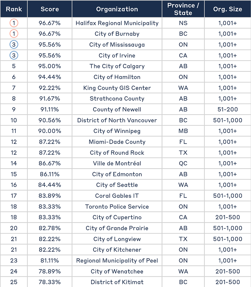
The Geospatial Maturity Index was developed in 2018 to help public sector organizations measure their GIS departments and program maturity amongst their peers.
The survey is organized into three sections reflecting the core competencies of a GIS program:
Through the GMI survey, participants showcased the innovative ways they use GIS to better serve the public and improve internal processes—including the use of GIS in public health during the COVID-19 pandemic.

The 2022 GMI Report provides an in-depth analysis of survey results as well as achievements and challenges of some of our top participants.