Using GIS for Municipal Asset Mapping and Disaster Preparedness
Geographic Information Systems (GIS) are a powerful tool used to capture, store, analyze, and visualize spatial data. Municipalities rely on GIS to map infrastructure such as roads, water and pipes, and streetlights, providing a geographic context for decision-making. GIS allows users to layer information, conduct spatial analysis and reporting, and track changes over time. One of its most critical applications is in asset management, where municipalities can use GIS in conjunction with asset management systems or tools to assess infrastructure conditions, predict risks, and plan for long-term sustainability.
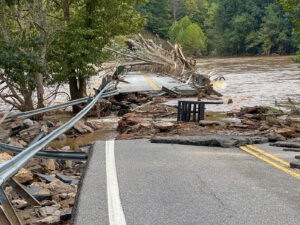
Mapping Damaged Assets with GIS
Municipalities should proactively manage their assets to ensure resilience when environmental disasters happen. GIS provides a framework for mapping assets and assessing their vulnerability to potential disasters. By integrating GIS with Asset Management tools, municipalities can:
- Identify at risk infrastructure – GIS can highlight the most at risk areas. Understanding an asset’s proximity to bodies of water, fault lines, or other risk factors help municipalities determine the likelihood of damage, and ensure that emergency repairs are carried out efficiently.
- Enhance maintenance – Tracking assets and using predictive tools ensures communities can take proactive steps to minimize disaster-related damage.
- Assess historical impact – GIS allows users to analyze the past, and predict how future events might impact infrastructure.
How Municipalities Collect and Analyze Asset Data
A critical aspect of asset management is collecting high-quality data in the field. Municipalities can use various tools, including mobile GIS applications and programs such as the Citywide Asset Collector tool, which allow users to collect data on the field, including condition assessments. With solutions like those provided by PSD Citywide, municipalities can:
- Capture and update assets in the field
Using mobile applications, field teams can document infrastructure conditions, ensuring that that data remains accurate and up to date.
- Visualize assets and their vulnerabilities
Understanding environmental risk factors and applying that to asset data makes planning for potential environmental disasters more simple.
- Create reports for decision-making
Available platforms provide municipalities with key metrics allowing them to allocate budgets and resources to at-risk infrastructure more effectively.
Data Accuracy and Quality in GIS
Municipalities must invest in accurate asset management systems that document infrastructure conditions before a disaster occurs. GIS will help answer important questions for municipalities to assess whether they are doing enough to protect their assets from potential disasters.
Firstly, municipalities should consider how likely an asset is to be affected by a disaster. To come to this decision, it must analyze geographic and environmental data. Secondly, the municipality should consider the probability of more than one disaster occurring. Historical data analysis can highlight trends and predict future risks. Thirdly, understanding how infrastructure failures affect the community ensures that response and decision-making processes are comprehensive and all-encompassing.
Above all, GIS can support proactive infrastructure planning, ensuring that assets are fortified against potential disasters, and confirming that municipalities don’t end up behind the eight ball when disaster strikes.
Conclusion
GIS is an indispensable tool for municipalities looking to enhance their asset management and preparedness. By leveraging GIS integration along with asset management tools, municipalities can ensure their infrastructure remains resilient against future risks. Municipalities that prioritize GIS integration will be better equipped to protect their communities, improve their budgets, and build resilience for the future.