Enterprise Asset Management Software for Municipalities
The Scalable, All-in-One Enterprise Platform
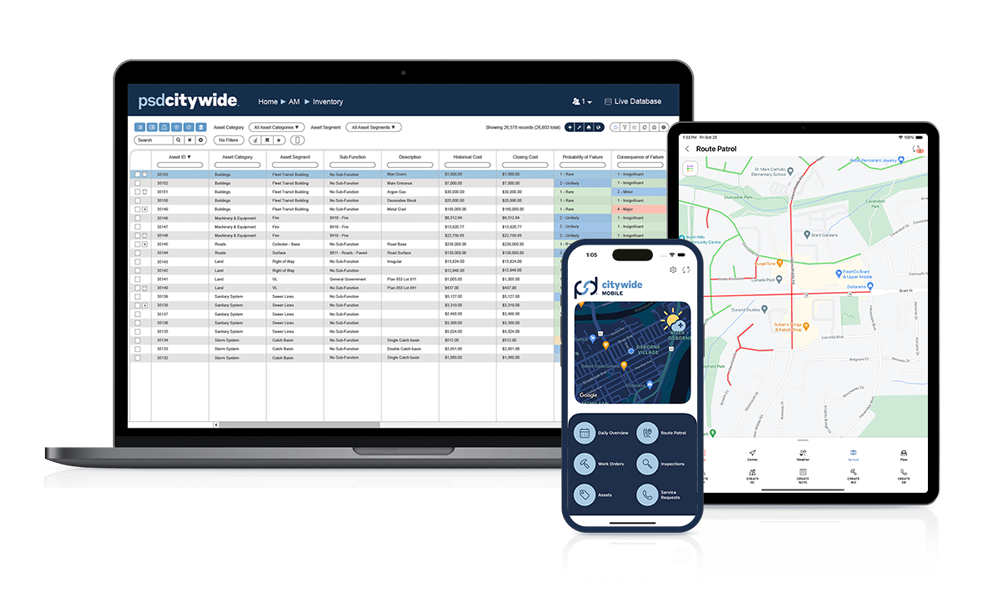
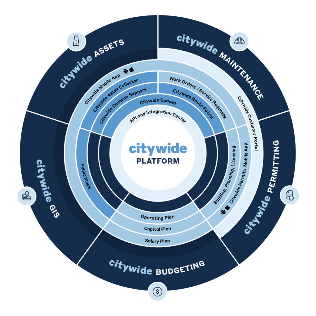
PSD Citywide software is an enterprise-wide Software as a Service (SaaS) solution designed for municipalities and public sector organizations. It provides integrated modules for asset management, maintenance management, permitting, planning, licensing, budgeting, and GIS, with a user-friendly interface that enables real-time data updates and straightforward access to essential features.
Better Enterprise Asset Management Software That Integrates
The Citywide Platform was purpose-built to be scalable, secure, and support the seamless sharing of data across all modules. Unlike other platforms which rely on different tools or third-party applications to share data, the Citywide Platform does so by design, resulting in a more reliable and cost-effective solution.
Scalability is also key, allowing organizations to build a solution that meets their needs and budget over time. Also, enhanced features like the Citywide Mobile App, Customer Portal, Public Maps and a robust API allow for greater flexibility, integration, and customization.
Asset & Maintenance Management Software
Enterprise Asset Management
Improve your infrastructure by centralizing data and applying industry best practices.
We partner with asset-intensive organizations like local governments, water and wastewater authorities, parks and conservation authorities and more to help them achieve best-in-class infrastructure management. Our expert advisors deliver comprehensive, end-to-end asset management services, working with you to establish or enhance your programs, build strong data models, and improve your decision-making frameworks.
At PSD Citywide, we help you streamline municipal operations with our powerful software solutions and advisory services. Our platform integrates every part of your workflow, with an industry-leading mobile app that keeps your team connected in the office and the field. Plus, our in-house experts ensure a smooth, hands-on implementation from day one.